Our Blog - Quimperlé, France
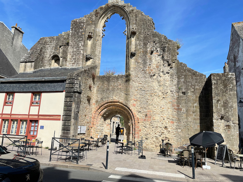
Last year, we visited the city of Quimper, and this year, we stayed near Quimperlé for a week. In Breton, it is spelled Kemperle, and comes from the Breton word "kember", which means "confluence" and the nearby river, Ellé. It is located at the junction of the valleys of the Ellé and Isole rivers. The lower part of the city is subject to flooding, which happened recently in 2000 and 2014 but there is a history of floods (too many to discuss). There is a historic distinction between an upper town and a lower town. The Lower Town (aristocratic and religious center) developed around the Saint-Colomban church of which only a facade remains and the Benedictine Abbey of Sainte-Croix de Quimperlé while the Upper Town developed around the Saint-Michel church and its square (original commercial center). It is not a village, but a small city of over 12,000 people.
We spent most of our time in the Lower Town, and started our tour with the remains of the west gable of the Saint-Colomban church. Legend says that this is the site that Saint Gurthiern created the first abbey. It was destroyed by the Vikings in 878 and rebuilt from the 11th century. It was abandoned in favor of Sainte-Croix Benedictine Abbey (that you will nee next) in 1792 and fell into disrepair. This west gable has a Romanesque doorway from the 11th century with what would have been a large Gothic window from the end of the 15th or the beginning of the 16th century.
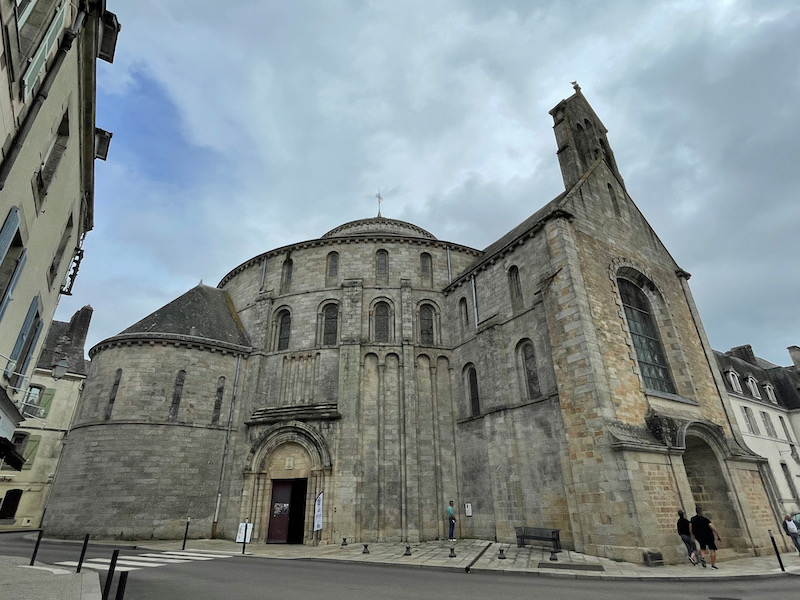
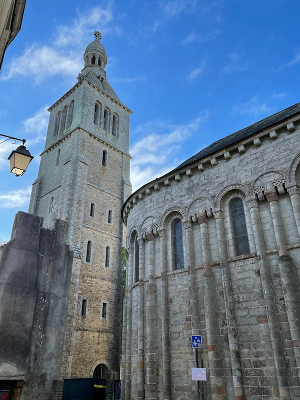
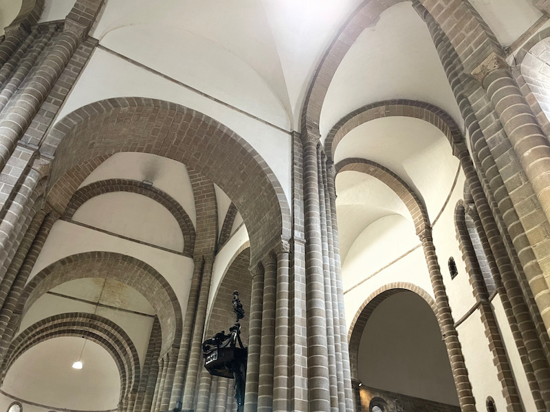
Sainte-Croix Benedictine Abbey The Sainte-Croix de Quimperlé Abbey was founded between 1029 and 1050. It is one of only two churches in Brittany to have a circular plan, modeled off the Church of the Holy Sepulchre in Jerusalem. It is also the tallest Romanesque church with a centered plan in France. The 17th-century bell tower collapsed in 1862 but was quickly restored.
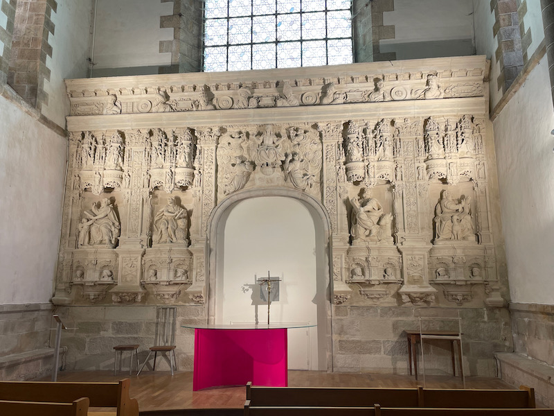
On one wall of the church is a large stone altarpiece carved in high relief. It looks a bit out of place here, which is understandable since when it was created, it was faced the main door of the church. It was moved to its current location in 1732. Above the former doorway is Christ with four angels, with Apostles, Cardinal Virtues, Prophets, and the Evangelists on either side.
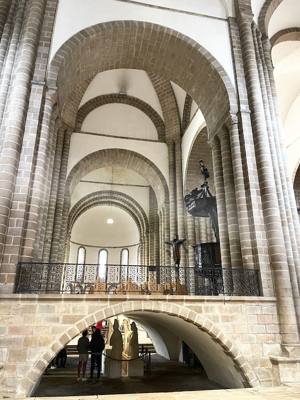
It isn't as easy as most churches to take pictures to give you a clear sense of the church. In the middle, there is a raised platform with a crypt underneath.
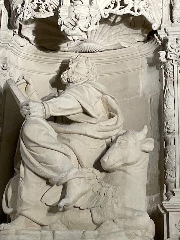
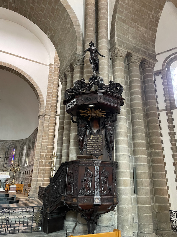
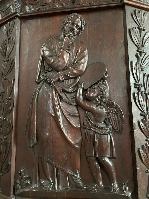
The pulpit dates from the second half of the 19th century. Four of the side panels are carved with high reliefs depicting the four evangelists: Matthew, Mark, Luke, and John. The roof is carried by caryatid angels and surmounted by the Angel of Fame.
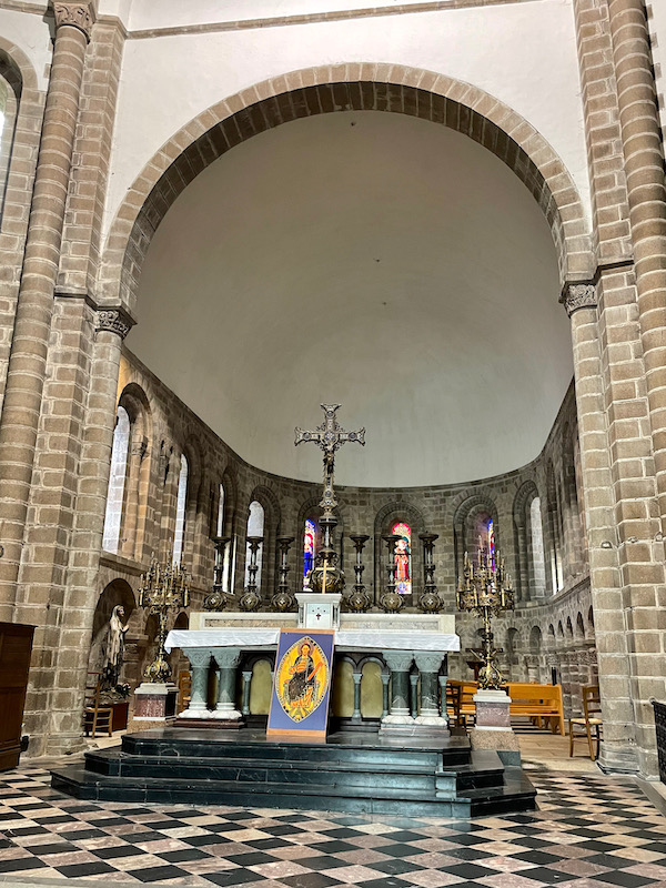
Above the crypt is the apse, also called the monks' choir. It has eleven tall windows to let in light.
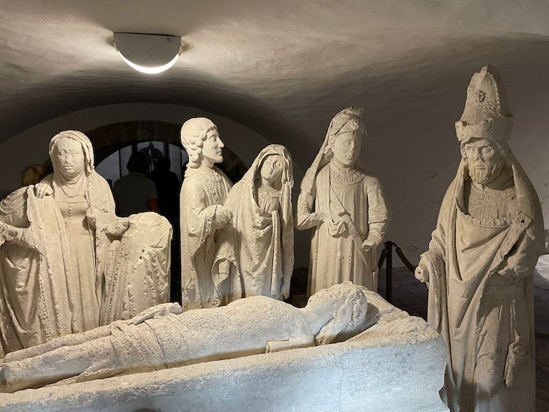
Under the crossing of the transept (you saw this in one of the earlier pictures) is a carved group composed of ten stone statues, which represents the Entombment of Christ. Dating from the end of the 15th century, it comes from the chapel of the Dominican convent of Quimperlé, where it was located during the French Revolution. You can see how it is a bit deteriorated ... it was moved for a time to an outdoor garden where it remained until 1956. Originally, it was polychrome but the colors were lost during all of the time outside.
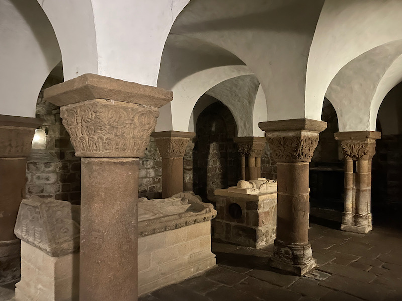
The 11th century crypt century is very well preserved and contains two recumbent figures: Saint Gurloës, the first Benedictine abbot of the abbey, and Abbot Henry de Lespervez.
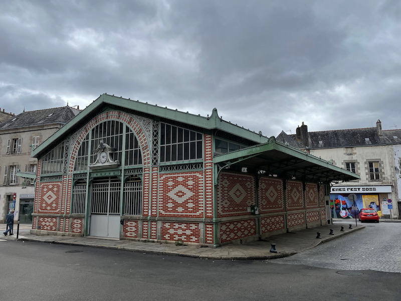
The halls of the marché, in wrought iron and brick with ornaments in cast iron and steel, were built in 1886 and then renovated in 2002. It was sad that they aren't used very well. There is a small market there on Sunday mornings but during the week, the inside is basically empty except for a very good fishmonger, who is there most of the week.
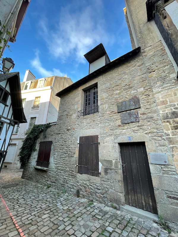
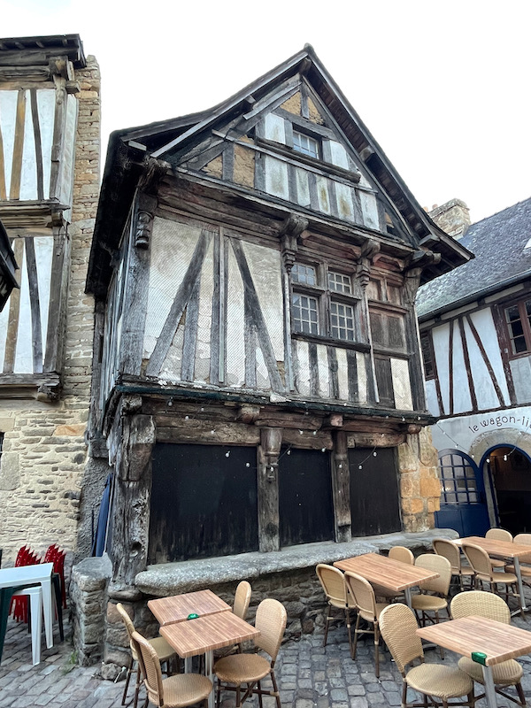
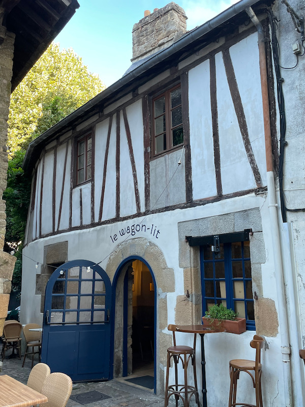
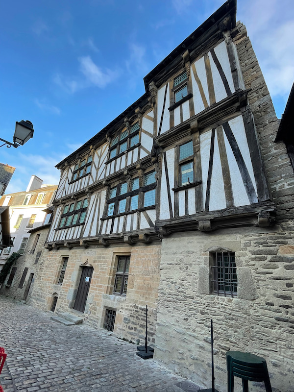
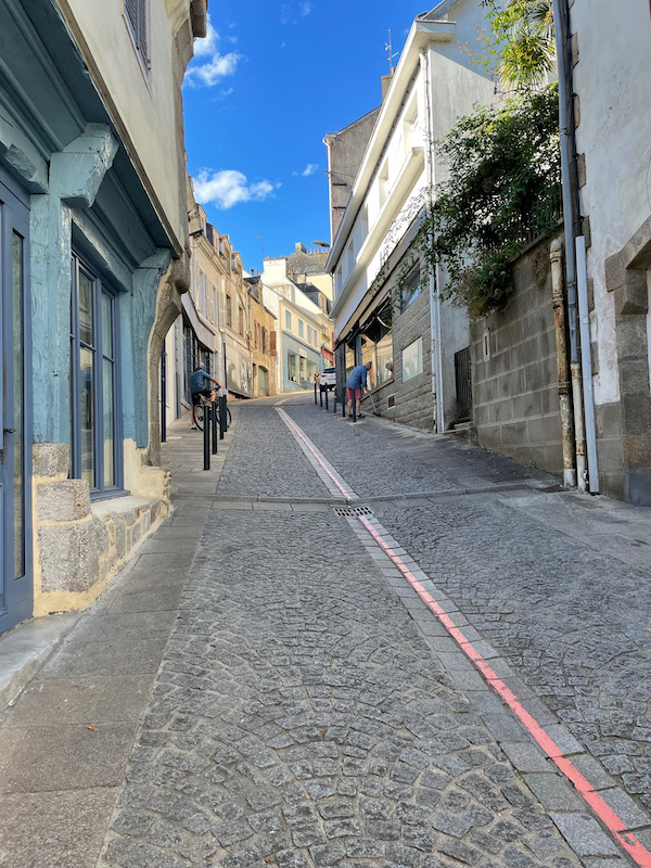
In the Lower Town, there are quite a few nice medieval houses on little tiny alleyways. The last picture is the "Maison des Archers", a half-timbered house from the 16th century that was restored in the 1970s.
The Lovignon bridge, also called "Pont Fleuri", was probably built in the 15th century. This bridge gave access to one of the three fortified gates allowing entry into the walled city. In 1746, a violent flood of the Ellé River washed away the four central arches of the bridge, which were replaced during its reconstruction by two large basket-handle arches.

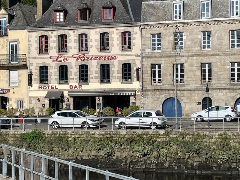
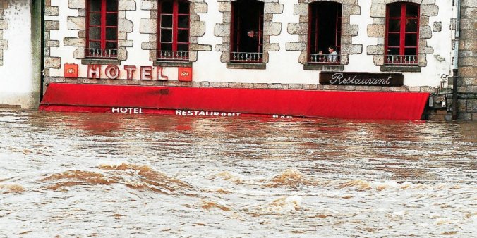
There isn't anything special about this hotel/bar in and of itself. However, it shows how horrible some of the flooding here has been. You can somewhat see the level of the water in this first picture, just at the very bottom of the picture. The second picture, which was in the newspaper Le Télégramme, shows the hotel/bar in December of 2000, when the "flood of the century" transformed the lower town. The "HOTEL" sign is in the same location, so you can see how, literally, the entire ground floor was under water.
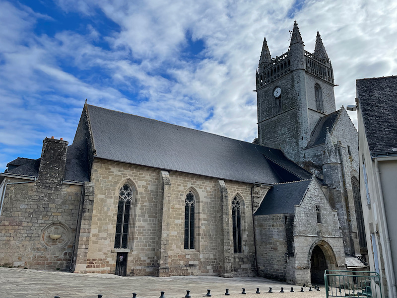
This side is the Upper Town, and you can see the large Eglise Notre-Dame de l'Assomption up at the top.
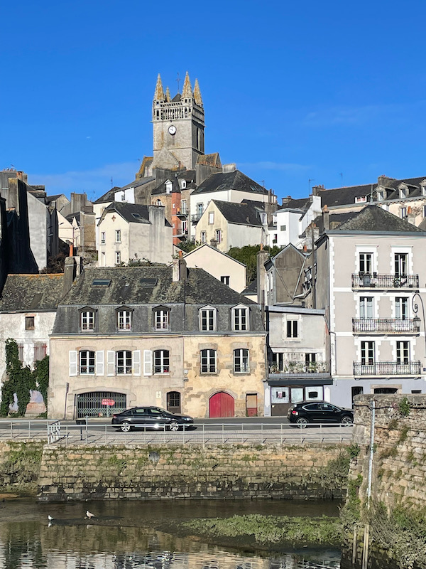
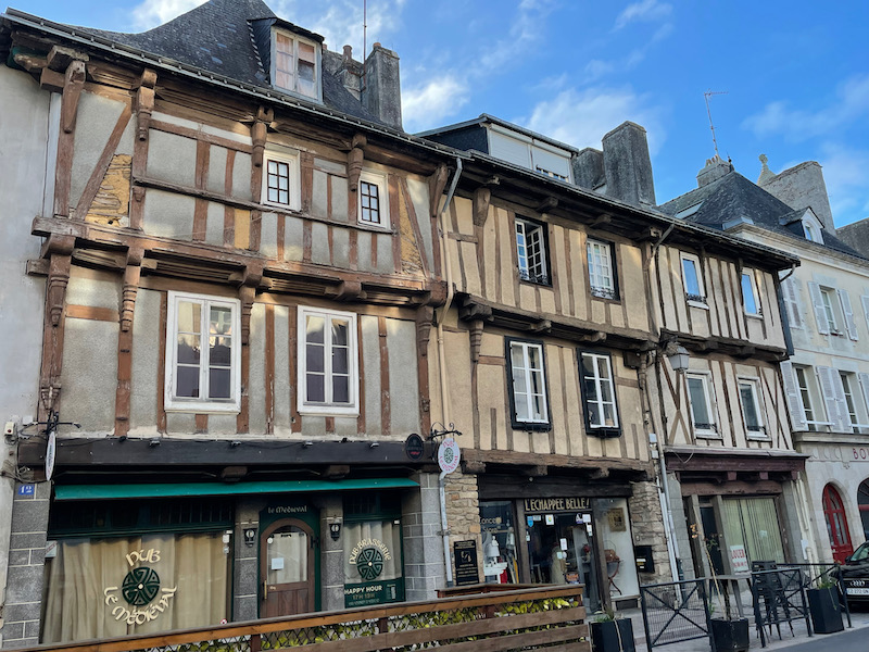
Both the Lower and Upper Towns are from the same timeframe, and here you can also see the narrow roads with older houses but this one goes up the hill to get to the church.
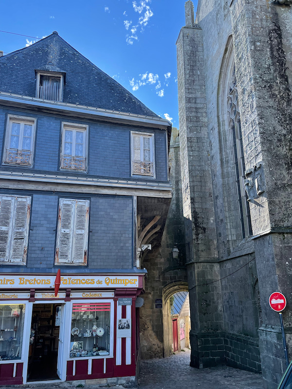
The Eglise Notre-Dame de l'Assomption is a construction of the 13th and 15th centuries, surmounted by a square tower. The original building was seriously damaged around 1373 and rebuilt in 1383. Of the original 13th century building, only the north and south walls of the nave remain. It sits right in the middle of the Upper Town, and as you can see from these pictures, the houses on either side are literally built into the buttresses.

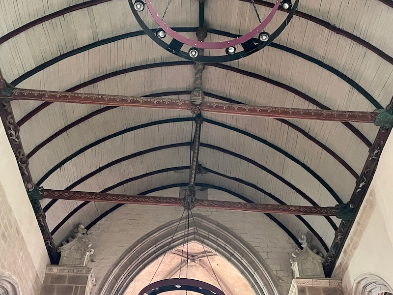
The interior has the typical inverted-boat ceiling but it much higher than many of the churches we saw on this trip. The arches are Gothic in nature, and you can see the typical Gothic ribs in the upper vaults.

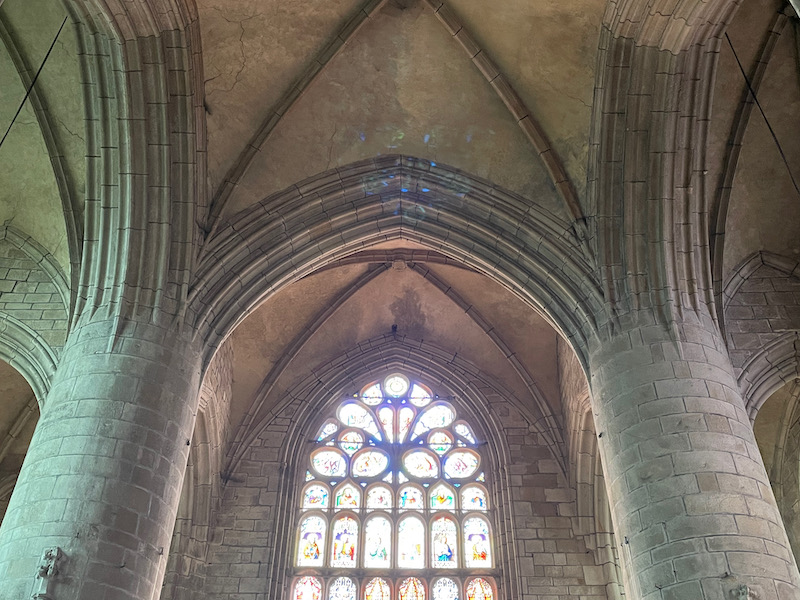
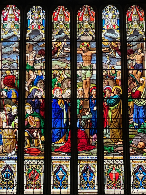
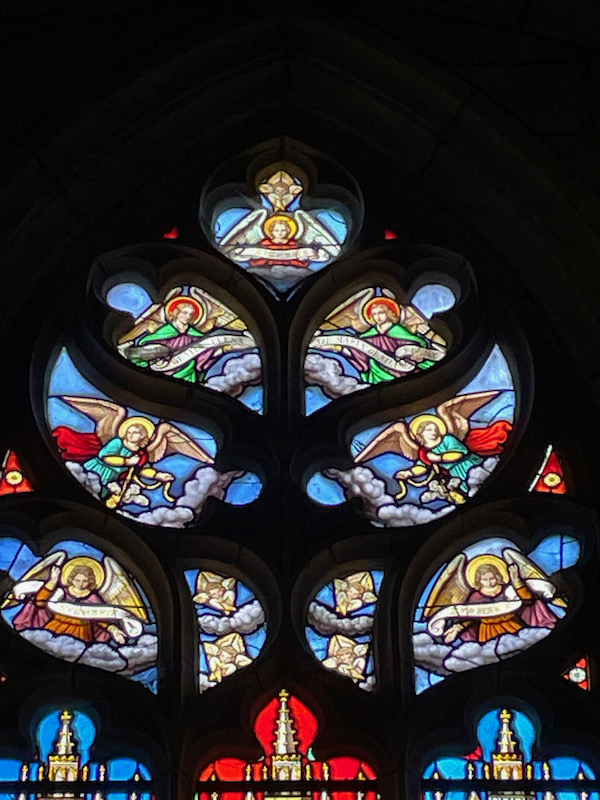
And then a couple of the stained glass windows.
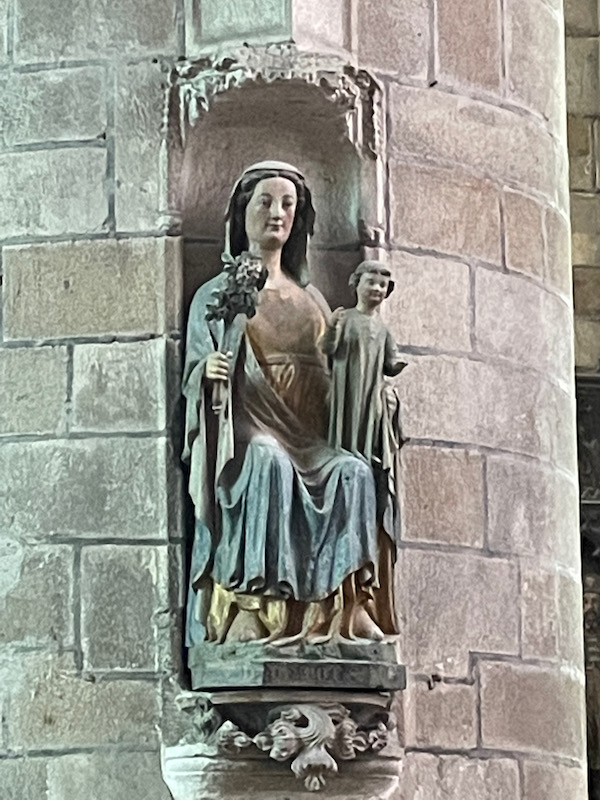
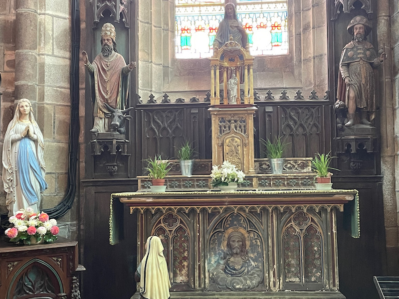
Some of the statues date back to the 14th, 15th, and 16th centuries.