Our Blog - Minerve, France
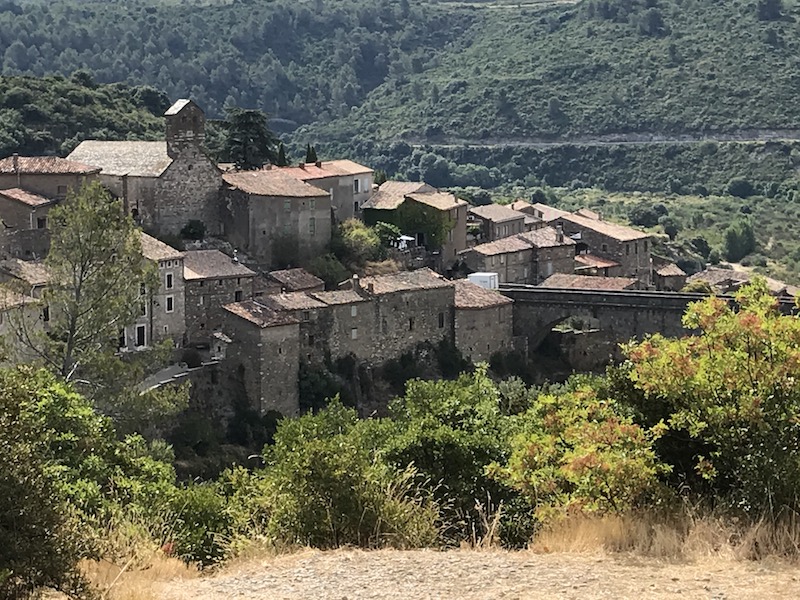
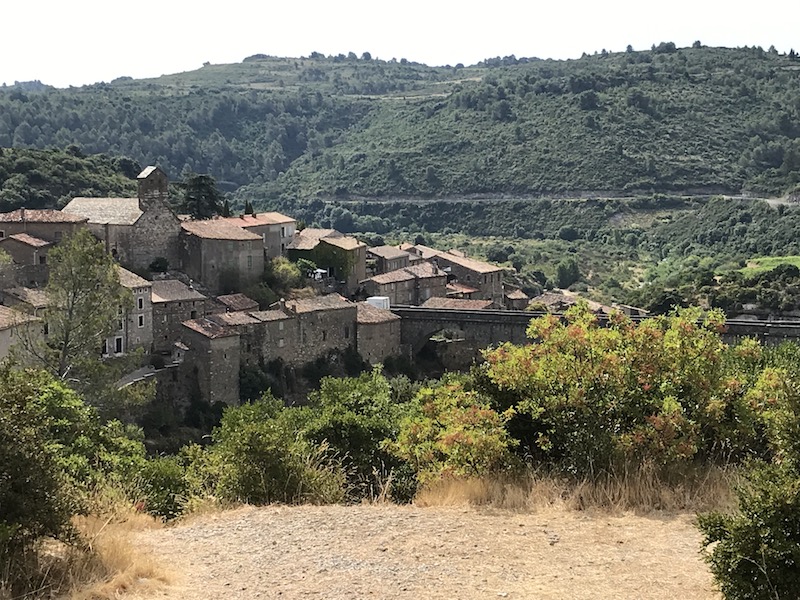
The village of Minerve is the historical capital of a natural region of France called Minervois (so not an actual French region or department). We knew about this area only because of the Minervois wines, which we tend to get at a certain cafe that we go to regularly. It is located in a vast amphitheater wedged between the Massif Central and the Pyrenees. Backing onto the Montagne Noire, its slopes dominate a low-altitude plain which crossed by several main roads, the Aude River and the Canal du Midi. To the north is the plateau de Minerve, with its pine forests and scrubland. This set constitutes a particularly favorable wine-growing region. The village is one of the "Plus Beau Villages".
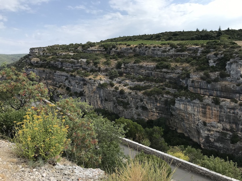
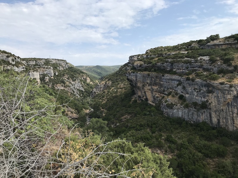
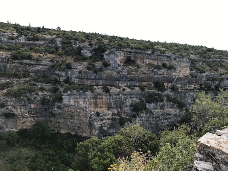
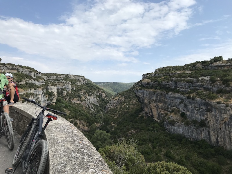
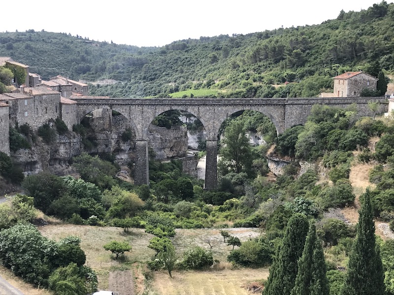
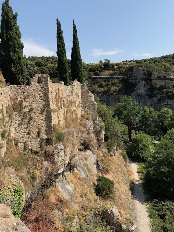
The village itself emerges in the middle of the plateau, protected by deep gorges of the Cesse and Brian Rivers, where water has shaped amazing natural bridges. The town only has about 120 inhabitants, but supposedly welcomes more than 300,000 visitors each year. As we made our way from the parking area to the town, we got a great view of the Gorges of the Brian River. The canyon was created through millions of years of erosion from the river, cutting into the alveoli limestone. During the Eocène period (50 million years ago), a warm sea covered the area, making it possible to find marine animal fossils such as oysters and sea urchins in the limestone cliffs.
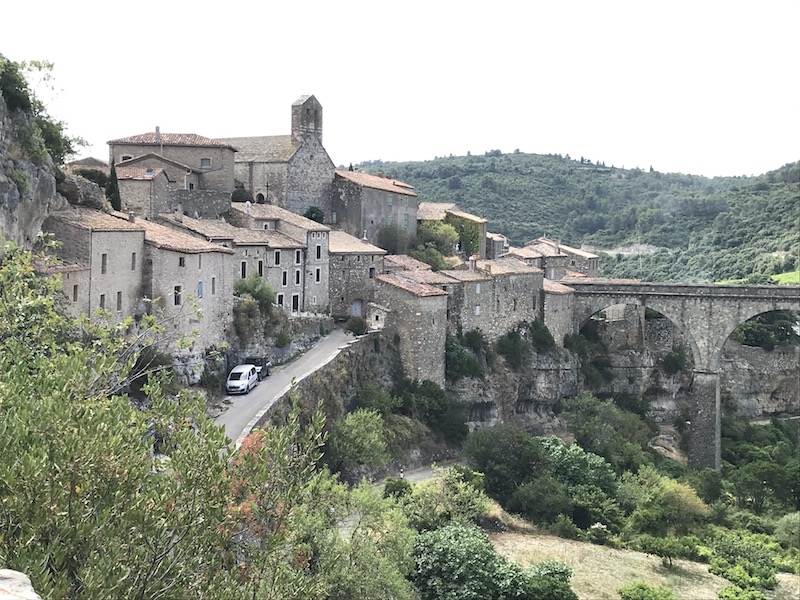
And a view of the village from across one of the gorges, this one being from the Cesse River. The bridge that you see is from the early 20th century.
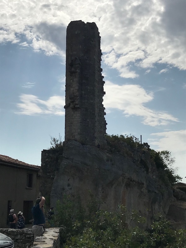
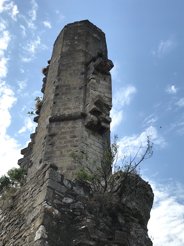
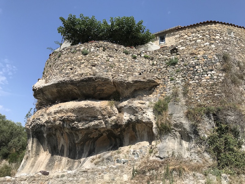
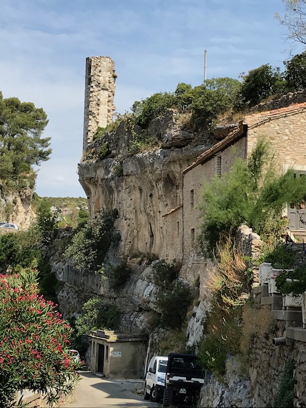
Not the best picture since the sun was not in the right place ... but this tall column is what is left of the Castle of Minerve. It is called La Candela and it dates back to the 13th century. It is most of what is left of the Viscounts castle (from the river bed, you can see part of another wall with windows). This octagonal bossed column bears the remains of two ledges which supported several floors. Part of the castle was dismantled in the 17th century by Louis 13th. The creation of a street in the ruins in the late 19th century brought the demolition to an end.
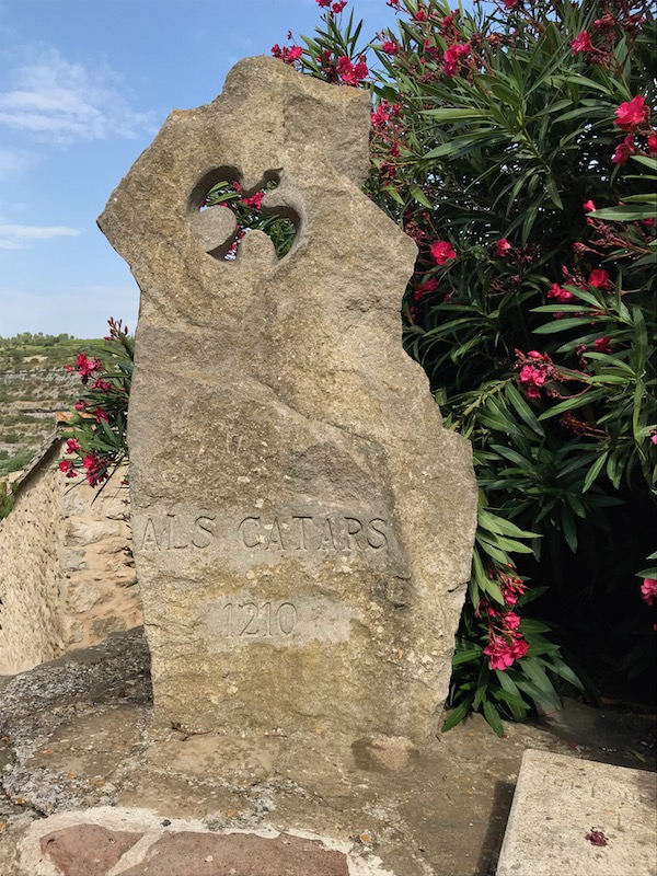
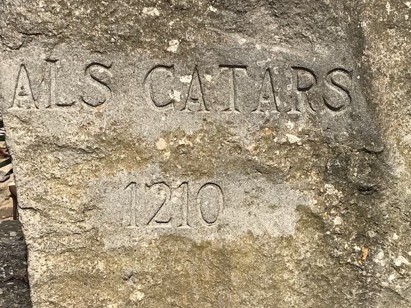
The St-Etienne church dates back to the 11th century. While we couldn't go inside, supposedly there is an altar in the chancel that can be dated back to the year 456, thanks to the engraving of the year on one of its sides. Next to the church is "La Colombe de Lumière" (meaning "the dove of light"), which is a stele in memory of the Cathars condemned to be burnt at the stake in 1210. More on this in a minute.
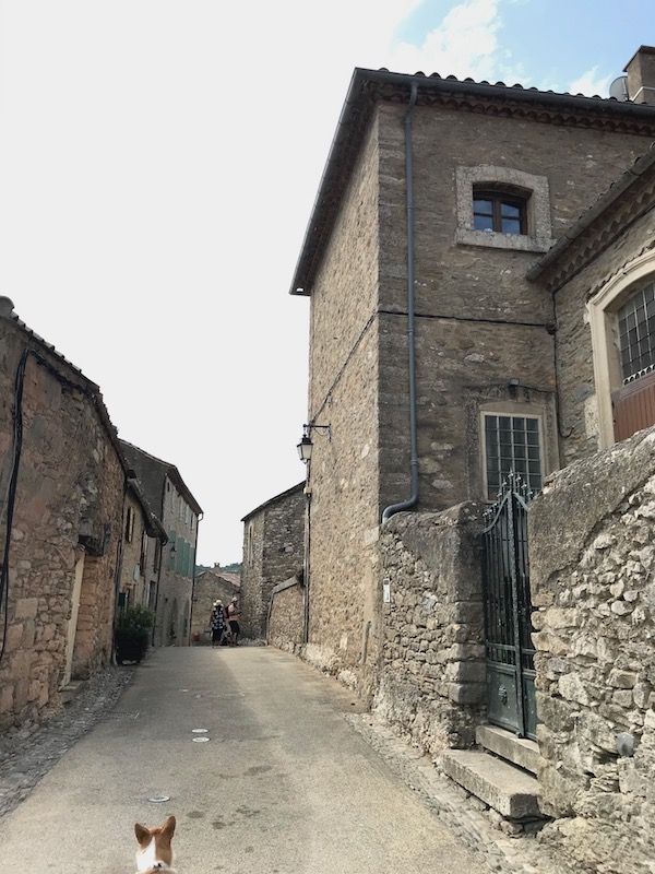
At the end of the village, you can walk down and get a view of the walls, and how they are perched on top of the rocks. Two walls protected the town: the first one enclosed just the village, and a second wall was close to the cliffs. The latter dates back to the classical period of the medieval era (11th -13th centuries).
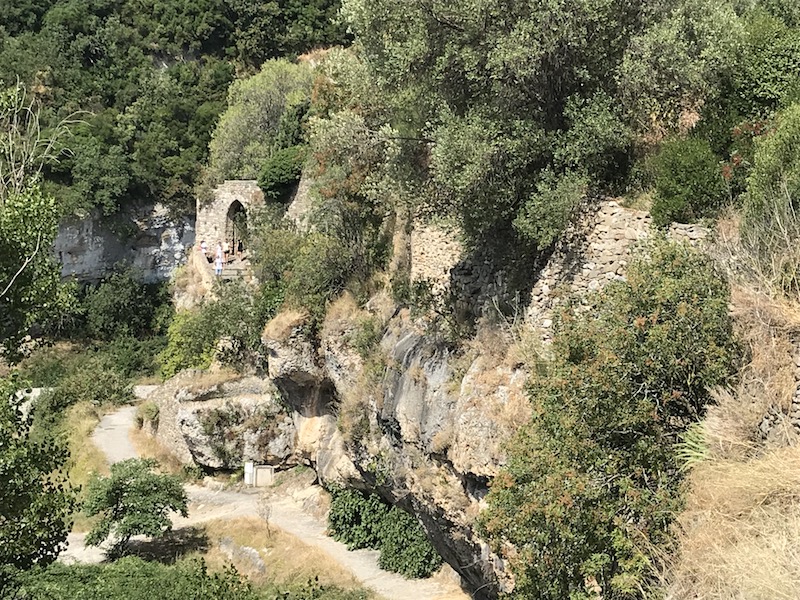
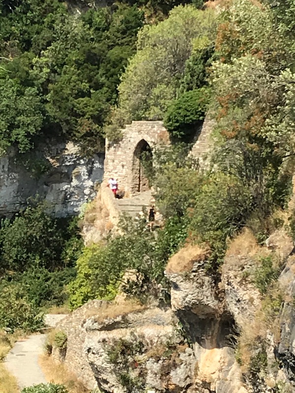
If you look in the middle of the picture, you can see a few people walking through one of the two "gates" into the city, La Pòrta Bassa. It probably dates back to the 13th century.
This is another view of the Candela, and you can see how the castle was built up on a cliff.
I mentioned that Cathars ... The Siege of Minerve was a military engagement which took place in June and July 1210 during the Albigensian Crusade. It was undertaken by the Catholic Kingdom of France against the Cathars in southern France, who were regarded as a heretical sect. The Crusaders, led by French nobleman Simon de Montfort, besieged and captured the town. The Crusaders allowed the soldiers defending the town, along with any Catholics, and Cathars who had not yet reached a specific status to go free. Three Cathars who repented were pardoned, but 140 others who refused to do so were burnt at the stake. One of the roads in town, rue des Martyrs, is named for these 140. Legend has it that the Cathars walked down that street and some chose to jump freely into the flames rather than wait for their executioners.