Our Blog - Foix
We didn't have anything planned for Saturday, so we decided on a road trip. You may wonder how we pick where we go. In this case, we wanted to go "about an hour" and "South". So we looked on a map, found the name of a town, found the webpage for the Office of Tourism for the town (yes, almost every town here has one), and saw what sights were listed. It seemed like it would be okay, so, off we went!
The city actually goes back to Roman times when a fort was built up on a rocky hill. Fast forward to 849 when the Abbey of Saint-Volusien was built. The founding of the Abbey allowed the development of urban living in the 10th-12th centuries, with the city peaking in the 14th century. During this urban growth, a castle was built up on the rocky hill where the Roman fort once stood, with foundations dating back to the early 10th century. By the sixteenth century the castle had lost its military purpose. The castle was then used as a prison until 1864. We did a tour of the castle, so I'll cover it in more detail later.
Probably the most important person ever from Foix was one of the Counts of Foix, Henry of Navarre .. he eventually became Henry IV, King of France.
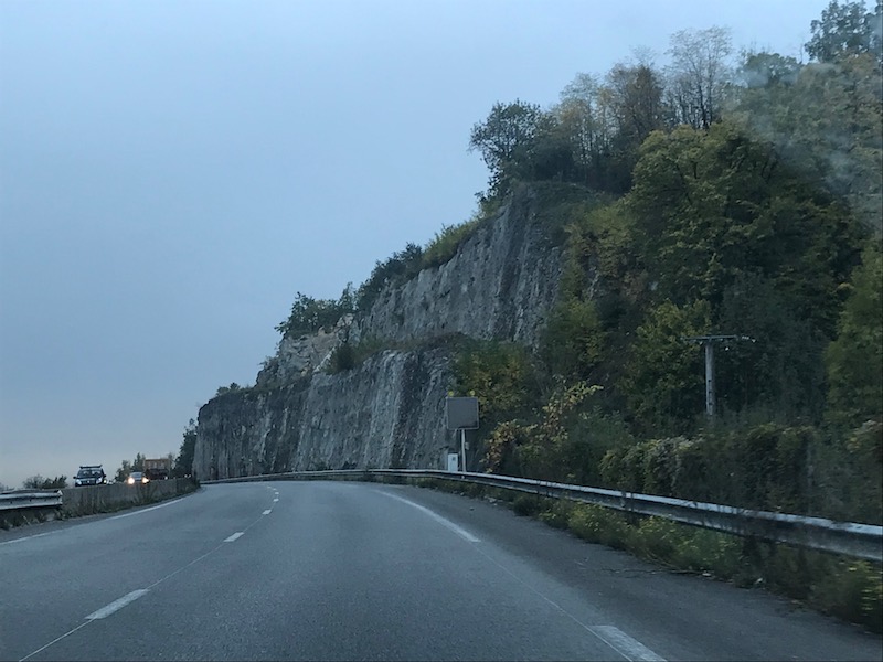
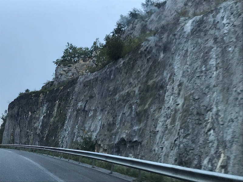
The drive down was quite nice ...we stayed off the toll-way and went on smaller highways down, basically to the foot of the Pyrenees. As we got closer to Foix, we started seeing lots of granite mountain cliffs.
We parked across from the Tourist Office and grabbed a map which has 2 tourist routes: the "route of the water" and the "medieval town". Then we were off...
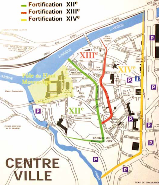
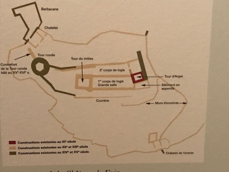
Here is a view of the city with a few notations, some of the items I'll walk about later, but to get you a good orientation. You can see the original Middle Ages town in yellow, at the corner of the two rivers, L'Ariège and the L'Arget. There is a rocky hill there where they built the original city, and the Castle. Two rivers, on a hill ... easily defendable, which was the key back then. The green, red, and yellow lines indicate the City Walls (fortifications) in the 12th, 13th, and 14th centuries. You can see how the city was growing and expanding, and they kept having to move the walls out. Next to the XIIIe indication is a bridge, that is the Pont Vieux or Old Bridge. The yellow line is the last fortification wall, and that is where the Allées of Villote are now, with the Pont Neuf (new bridge) shown with the oval in the middle. The name "Foix" comes from "Foueich" which means "fork", and it is at the "fork" in the two rivers.
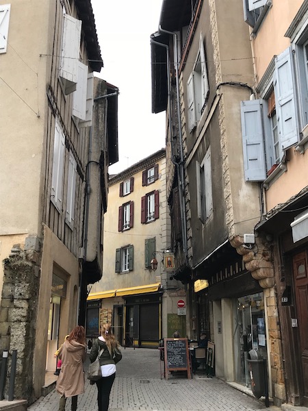
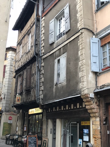
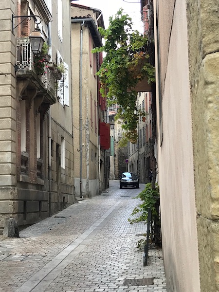
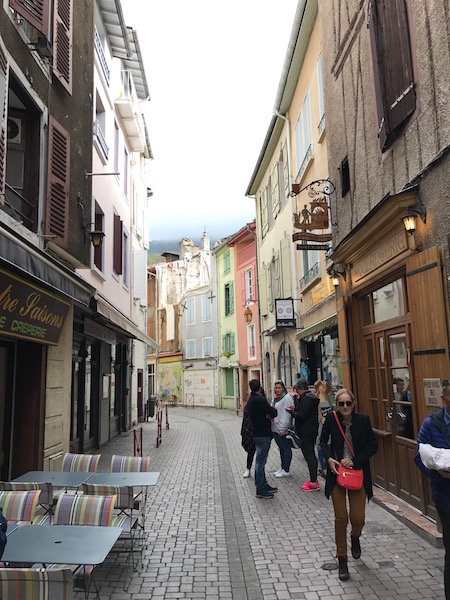
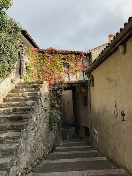
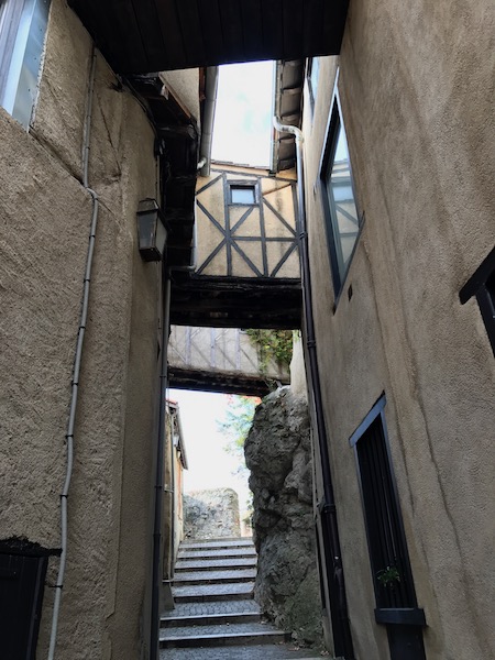
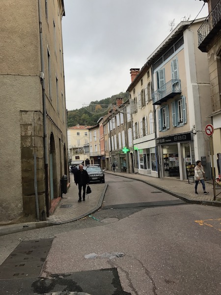
The old part of the town still retains its medieval character, with narrow, winding streets and half-timbered houses. Many of the street names also reflect specific trades within their names.
The first street was La rue Labistour (which from what I can find, doesn't have any particular meaning). It is located where the 13th century ramparts one were. In the 14th century, it became home to rich cloth merchants who built private houses here.
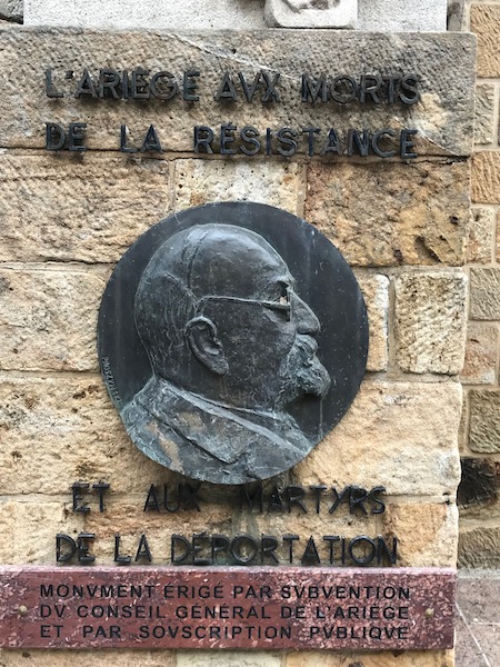
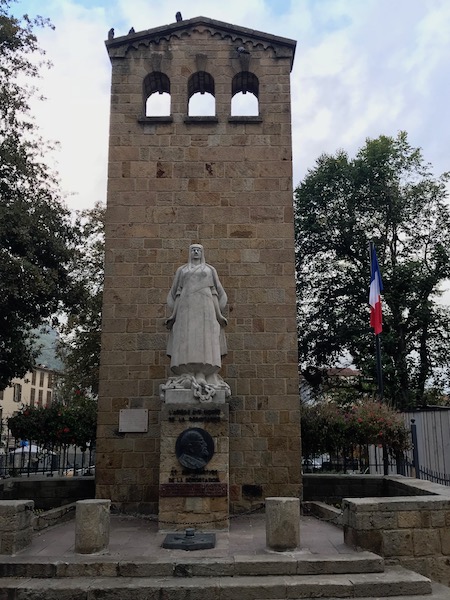
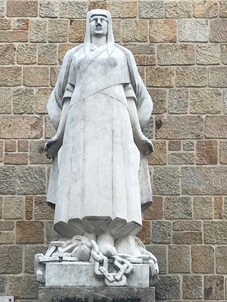
Near the Tourist office is a public garden, along with a monument for the department of Ariège to those who died during the resistance and to "the martyrs" of the deportation. The monument is in the shape of a bell-tower with a stone statue of a woman with broken chains at her feet. The medallion is that of a member of the French Resistance, Irénée Cros, who was killed in 1943 by Germans in what came to be known as "The Midnight Operation. When the Gestapo came to his door, he quickly burned all of the incriminating papers in the fireplace. This made the Gestapo furious and one of them shot and killed him.
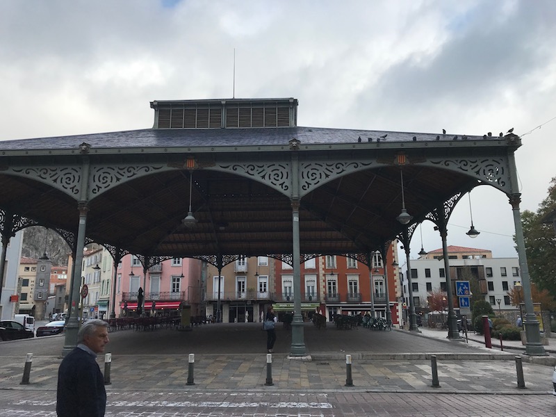
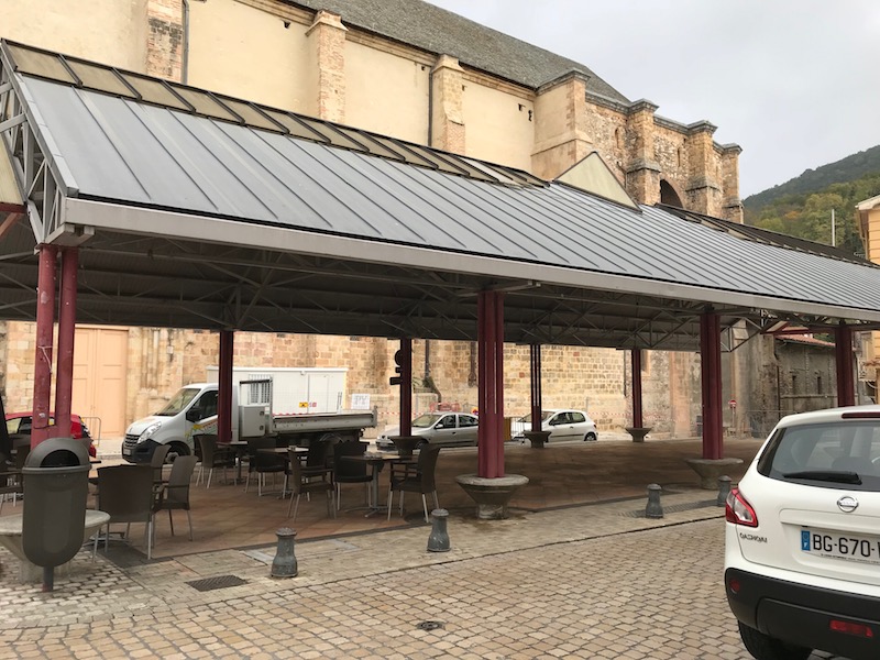
This is the Halle aux Grains, which is an open-air market hall. Originally built in 1870 and renovated in 2009, it is designed with a Baltard-style iron pavilion. The style is named for Victor Baltard, the French architect who created Les Halles in Paris, the iron-structure markets in Paris in the 1860's that were mostly destroyed in the 1970's. There is one surviving Baltard Pavillon that was moved to Nogent-sur-Marne to save it from destruction.
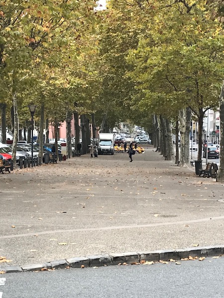
The Allées of Villote is a large area that today is home to the city's market (every Friday) as well as being used for a lot of different activities and events throughout the year. Case in point, the Saturday that we were there, there was a Chrysanthemum market setup there, as, well, it is "that time of year". The city ramparts used to be at this location, and when they were destroyed, they decided to build this large, tree-lined area. It served as a transition between the old town and the newer neighborhoods as the city expanded outside of the city walls. In 1963, the "new bridge" was built connecting the other side of the river to the roads that go around the Alleys.
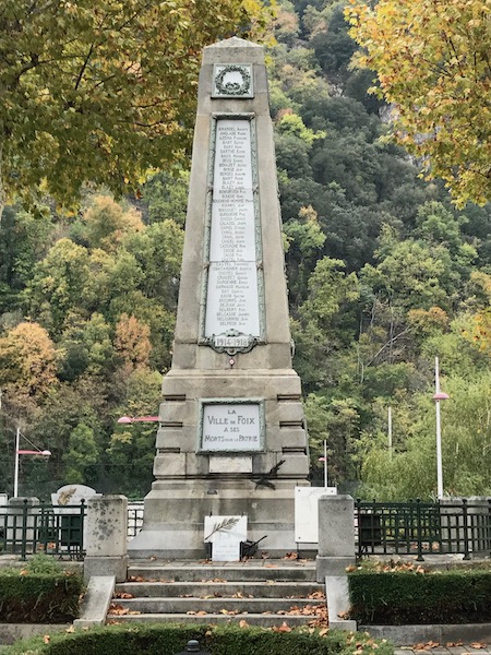
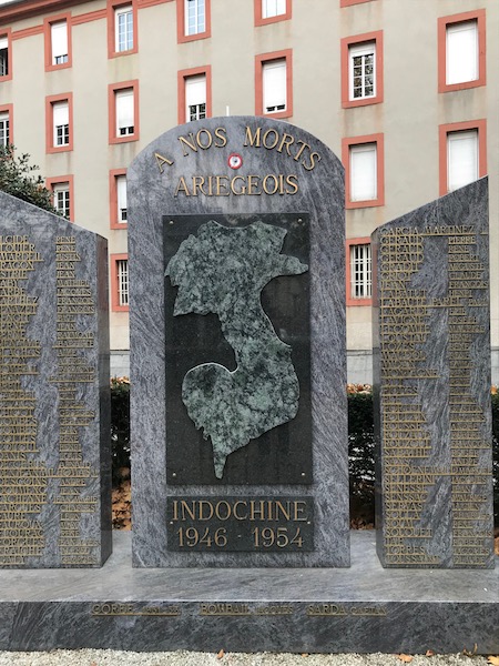
At one end of the Allée is another monument to the dead, including one for the Ariège department during the war in Indochina from 1946-1954 (or what Vietnam calls the Anti-French Resistance War). From a French perspective, it ended in 1954 with the French defeat at Dien Bien Phu, and it (basically) escalated into the Vietnam War (also called the Second Indochina War or, in Vietnam, the Resistance War Against America).
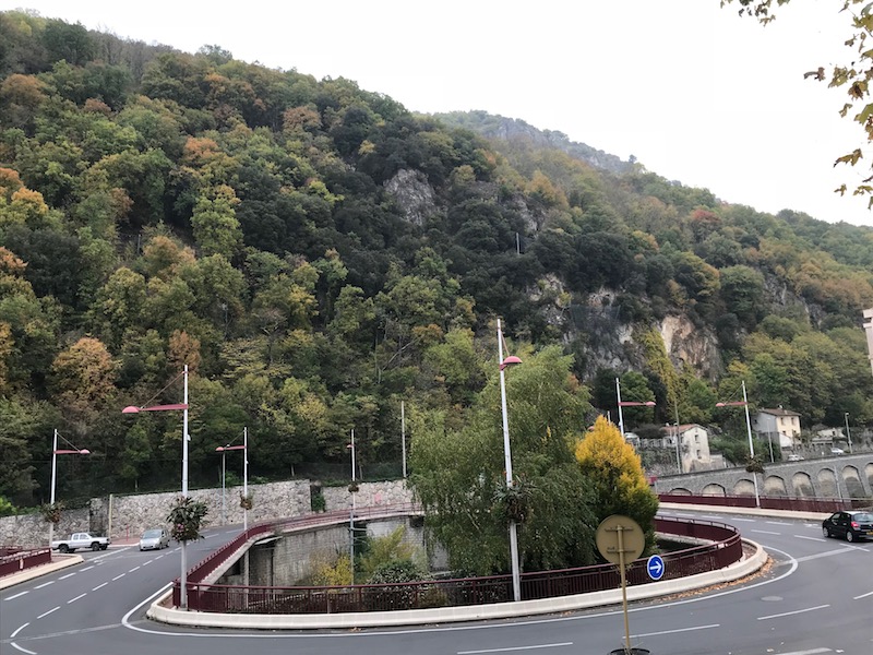
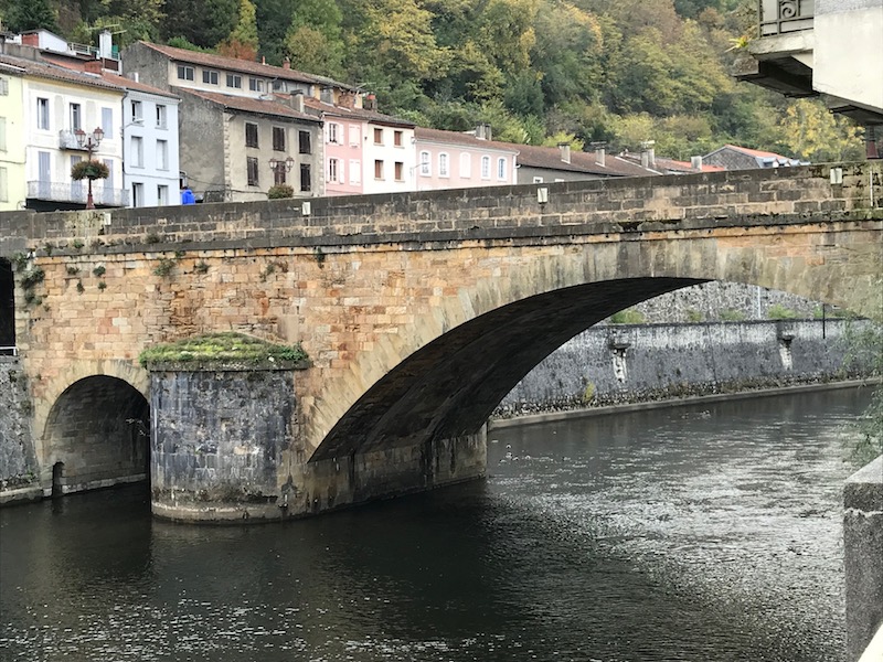
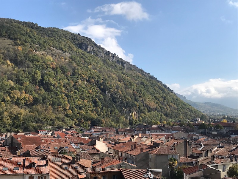
This circular bridge goes over the Ariège River, at the foot of the hills. You can see how the town sits at the foot of the mountains. In fact, we were told that Foix sits in a valley, surrounded on all sides by hills/mountains, with only 2 entry points. This made it a perfect location for a town as it was easily defendable.
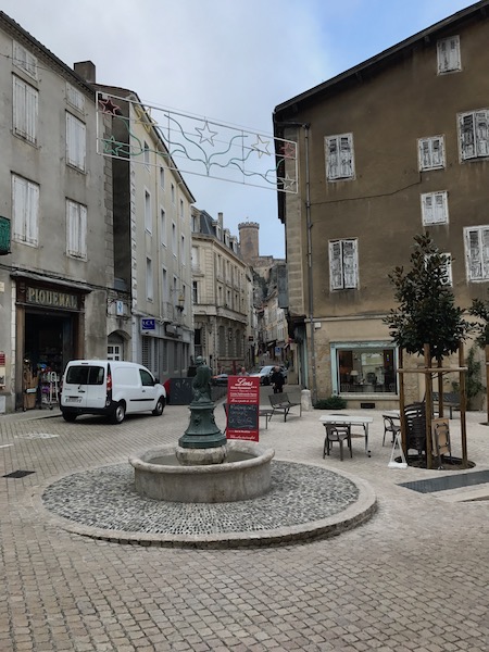
From the middle ages, this neighborhood was part of the "new town". Place Dutilh hosted markets, and has a fountain where villagers would come to get water, just up until the town got running water. This fountain is equipped with a resting "lip", where villagers would set the jugs that they would fill up from the fountain. As you can see, they are getting ready for Christmas with the lights that have started popping up across the various streets. You can also see in the 2nd picture, a couple of the medieval half-timbered houses (behind the white car) on both sides of the road leading out of the place.
This is Pont Vieux, or the old bridge dates back to the 12th century. Prior to its' construction, the only way to enter the town was through a toll crossing at a place on the river where it was shallow enough to walk across. This was (of course) controlled by the Abbey, making the Abbey quite rich. This made the Counts jealous and therefore, they built the bridge, to try to show that they were more powerful than the Abbey. It remained the only bridge across the Ariège River in Foix until 1963.
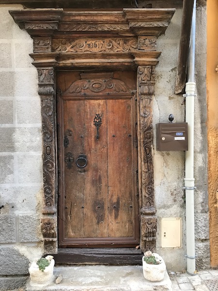
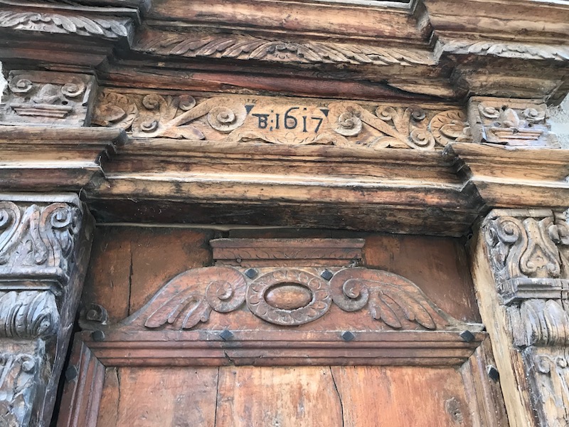
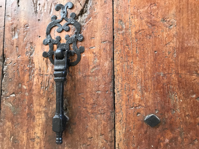
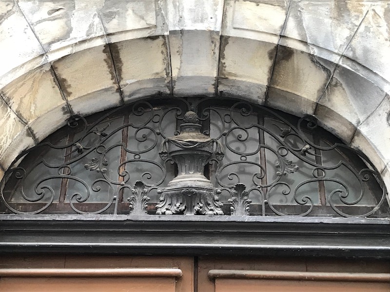
Rue du Rival runs along the banks of the Ariège River starting at the Pont Vieux. At #37 is a carved wooden door dating back to 1617. It is a Renaissance style door and is decorated with a forged iron handle and fine wood sculpting across the top and on both sides.
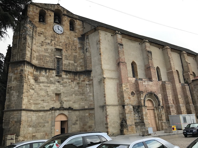
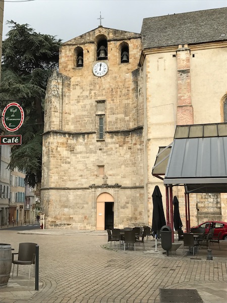
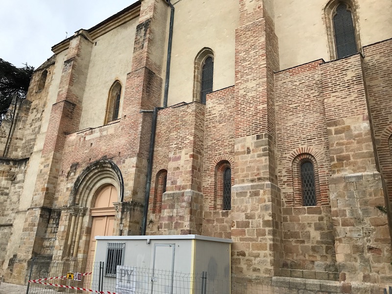
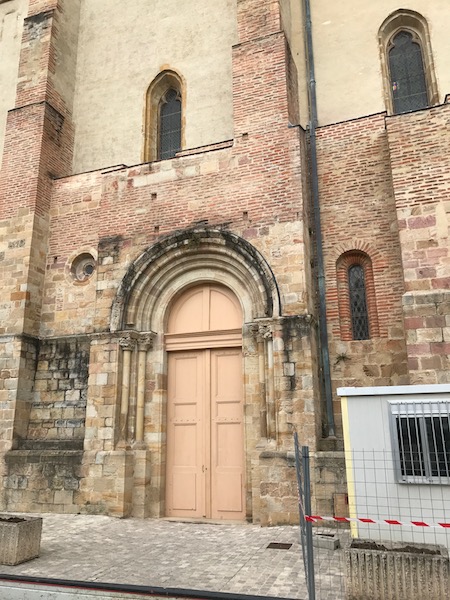
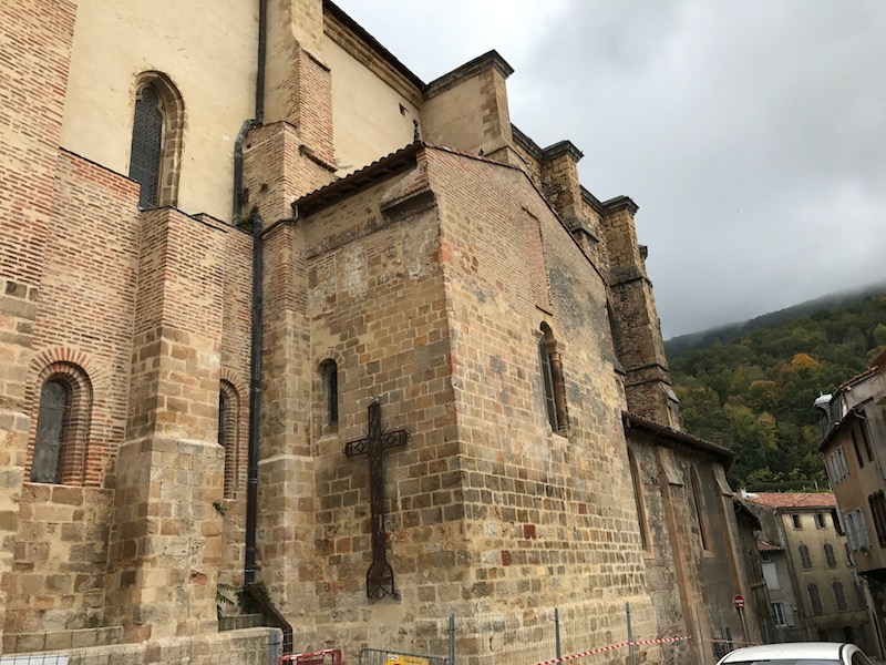
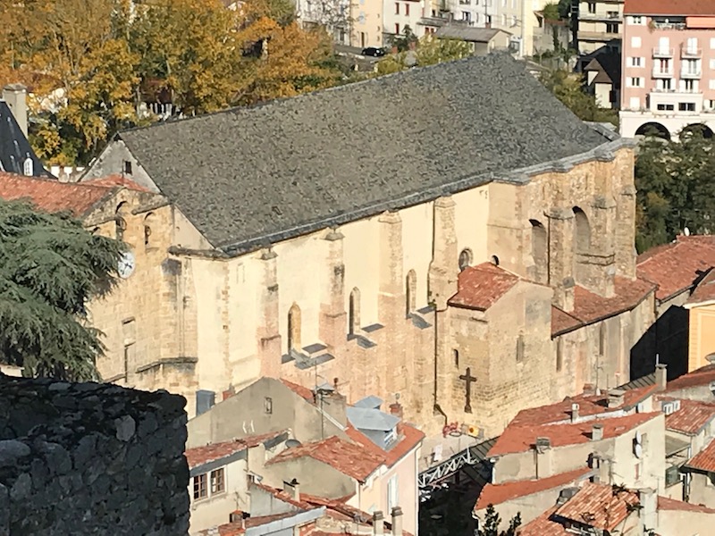
One of the biggest sights in the town is the Saint-Volusien Abbey. The original church here dates back to 860 although it has (like most old churches) undergone multiple alterations and reconstructions due to religious wars as well as fires. You can clearly see two very different church styles ... the older Romanesque parts and the newer Gothic parts. So the original 860 church (which is pretty much gone) housed the relics of St. Volusien (7th Bishop of Tours from 491 to 498, and the patron saint of Foix). In 1112, a new Romanesque church was inaugurated (some of which you can still see) but then the apse was replaced by a new polygonal chancel in the 14th century. The building was destroyed during the religious wars and the relics were burned. Reconstruction work was undertaken from 1604 and completed in 1620. Of the medieval (Romanesque) church, there are mainly the portal and the base of the walls of the nave remaining.
At the back, you can see the small bell tower, which dates back to 1682. There are 3 bells, 1 from 1641 and the other 2 from 1803. You can clearly see the Romanesque (round top) door in the middle along with several Romanesque (round topped) windows on the ground floor. This door and wall date back to the 1104 church. The Gothic windows above them date to the 1600's Gothic reconstruction.
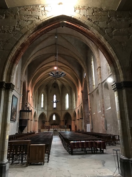
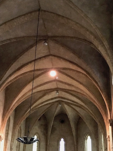
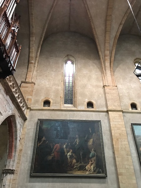
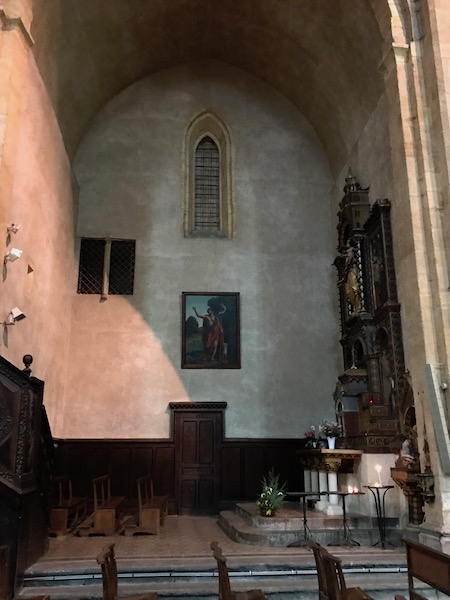
And now the interior. You go through a Gothic arch and enter the long Gothic nave, with it's very high vaulted ceiling. The paintings along the walls date to the 19th century. Up past the short transepts are 9 side chapels (none in the main part of the nave).
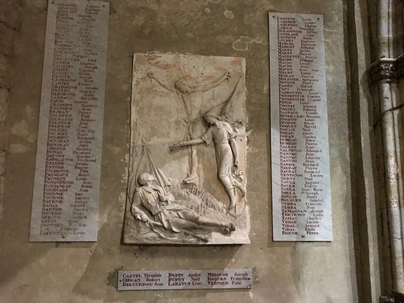
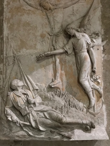
The Monument to the Dead is quite nice, with a bas-relief that shows a fallen solder.
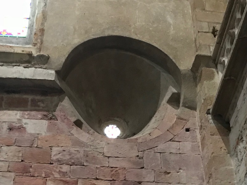
So this is kinda cool ... you can go back up and look at the Romanesque doorway and look just left of it, and you see what the call the "Bull's eye window".
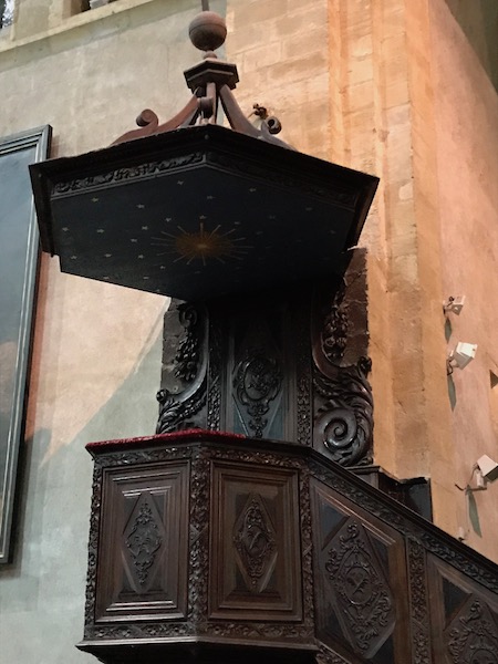
The pulpit is carved wood. Not as grandiose as others, but very well done.
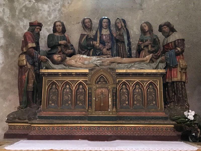
This is called the "entombment" and while it looks like wood, it is painted terra-cotta. It is a copy made in the 19th century (interestingly enough, the information in the church says that the 16th century original is on display at the Met in NYC .. we'll have to go find it next time we are in NYC). It shows the Virgin Mary overlooking the dead Jesus. Around her, you can see St John (with a crown of thorns in his hands), Mary Magdalene with long hair and carrying a perfume box, along with 2 people holding the shroud wrapping Christ's body.
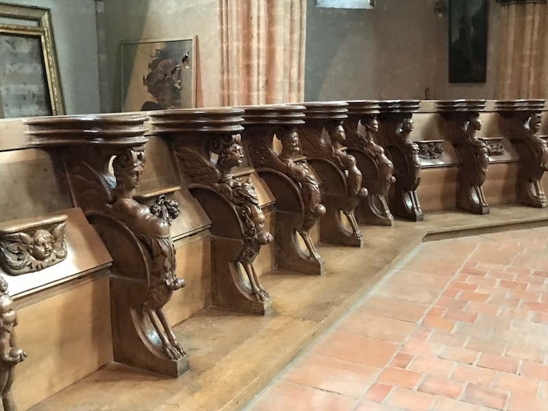
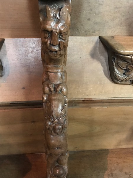
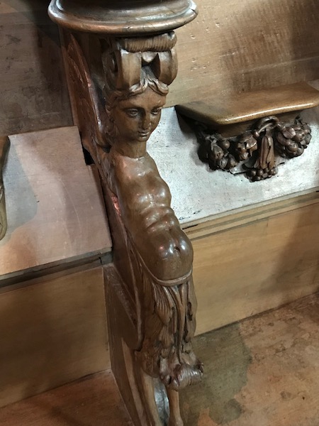
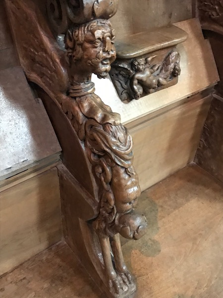
This part was really interesting to us, living now in Toulouse. The carved wooden stalls date back to 1670 and actually come from the Basilica of Saint-Sernin in Toulouse. They came here in 1804 (not sure why). Each stall is separated by a sculpture and every sculpture is different!
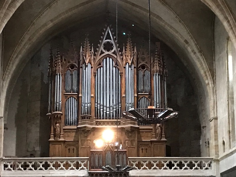
The organ, built by Fermis, dates back to 1869.
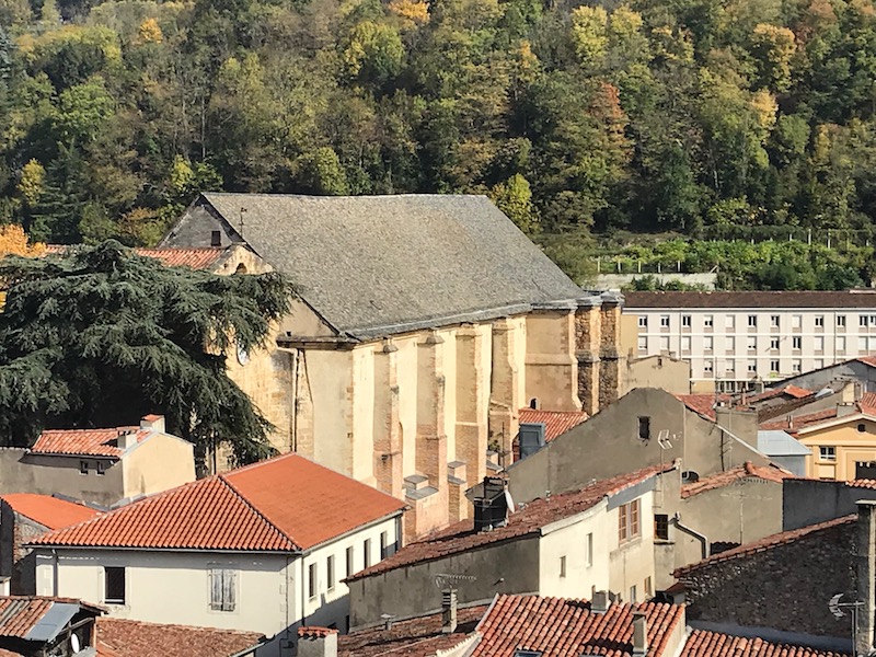
These show the Abbey from up on the hill where the castle is, trying to get a view of the whole Abbey, that you can't get from ground level.
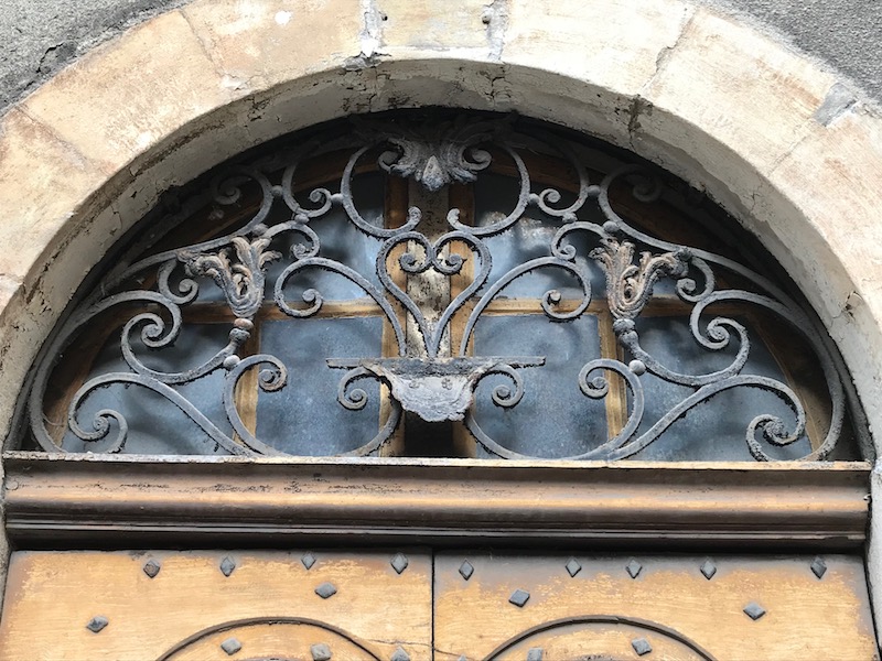
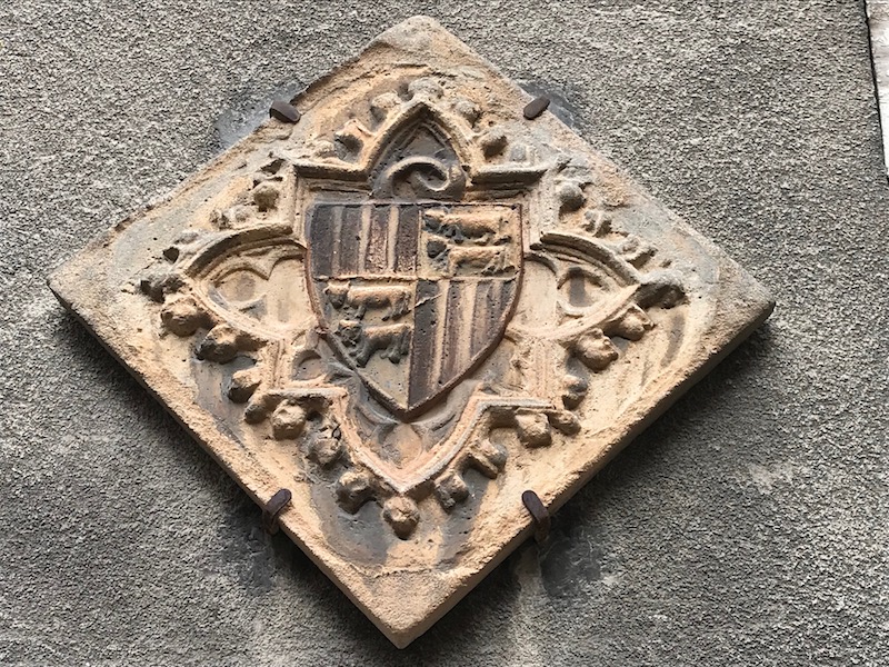
I mentioned that in the medieval city, that many of the street names had meaning ... this street is Rue de la Faurie which specifically is for those who worked in the various medieval metal forges. In the middle ages, Foix specialized in iron works thanks to local mines. On this street, several of the houses have doorways that have really nice iron lace-work above the doors. As well, there is one that has a carved coat of arms of the counts of the Maison du Bearn, which has cows on it.
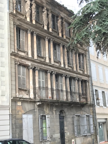
Next to the Abbey is the Place Saint-Volusien and it was the commercial center of town up until the 19th century. At the start of the 20th century, the original wood hall was replaced .. I'm not a big fan of this one, personally. One one side of the place, across from the back of the Abbey, is a building with 3 rows with columns, the top row with sculpted Caryatids.
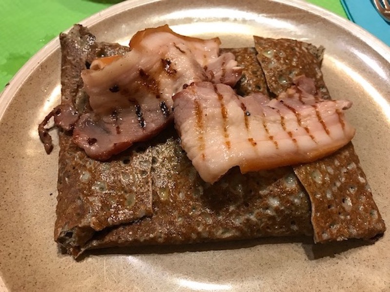
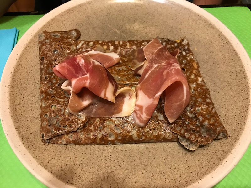
Then it was time for lunch, and we found a creperie in the old town. Interesting thing about the crepes were, the meat was put on top, not inside! We had one with bacon, and one with Serrano ham.
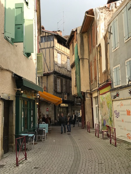
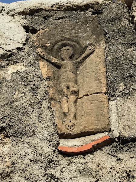
The Rue des Grands Ducs is one of the last vestiges of medieval buildings, it is a narrow, windy little lane. On one of the buildings, there is a sculpted stone in the wall, which somewhat looks like a religious symbol. A couple of the houses have bridges across the road that connect houses on either side of the street.
Another couple half-timbered houses looking up Rue Lazema.
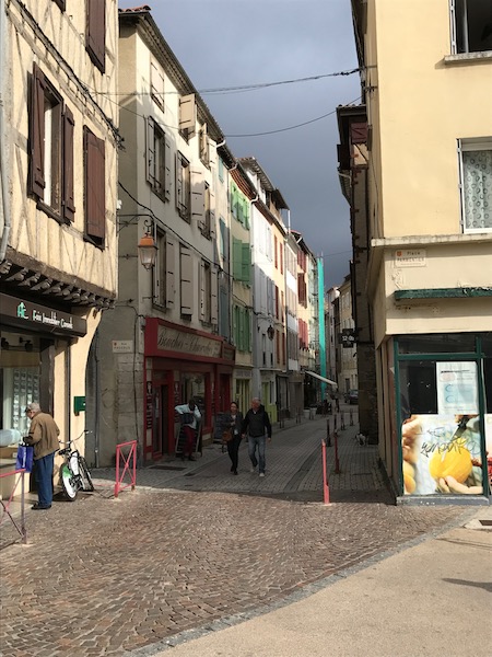
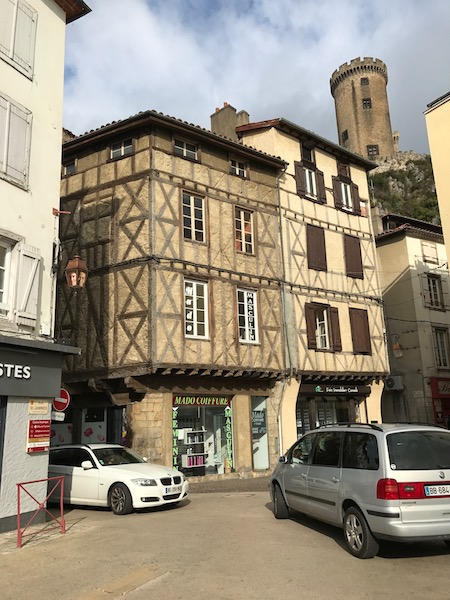
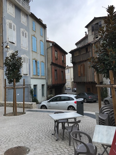
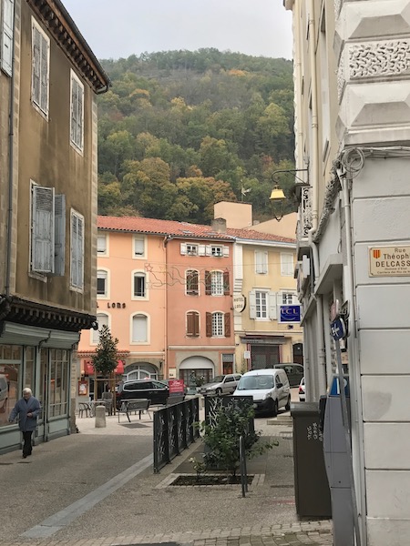
A few other looks in the medieval city ... in addition to half-timbered houses, there are lots of nicely colored houses, mostly just the ground floor (with mostly shops) and 2 or 3 stories above.
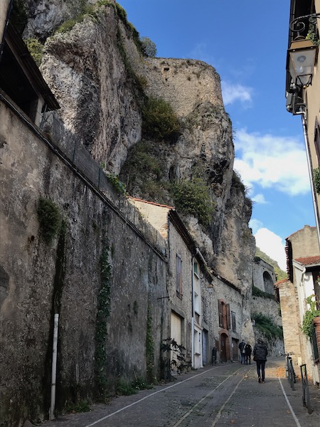
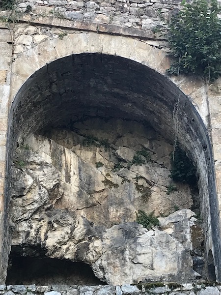
Then we headed up Rue du Rocher towards the castle, which stands on a rocky outcrop. As you can imagine, with a name like Road of the Rock, it goes up directly alongside the rock, which was formed from sedimentary limestone from the Cretaceous period. The houses on the rock-side are built directly into the rock, and many of the homes use cavities in the rock for cellars, and even some garages are put directly into the rock. They build walls on the inside of these cavities. In one of the caves, there are cave paintings of horses that are dated to the end of the Paleolithic period.
The majority of the present building dates from the twelfth century to the fourteenth century. In the North, the square tower, covered by a slated roof at the end of the nineteenth century, is certainly the oldest because it dates the eleventh and twelfth centuries. The middle tower, built in the thirteenth century, was completely renovated in the fourteenth century. It has beautiful architectural features such as sculpted heads and coats of arms keystones. The round tower on the other hand has Gothic architecture with large bays illuminating beautiful hexagonal vaulted halls.
As we came into the main gates and headed up the path to the top ... I'm not exactly sure what these arched openings are, but there a few of them.
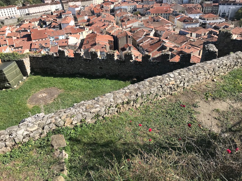
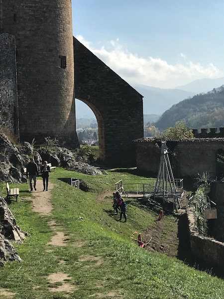
I also took several pictures from the top of the general area around. Looking down from the wall, you can see the various terraces where soldiers could defend the castle from anyone who would try to attack.
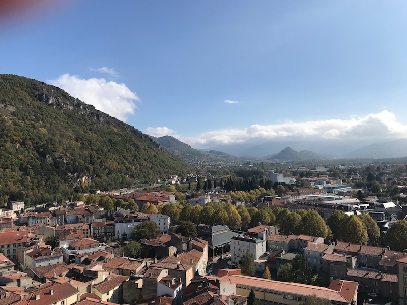
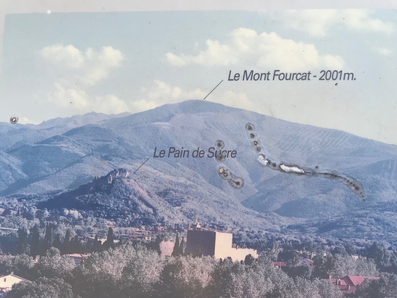
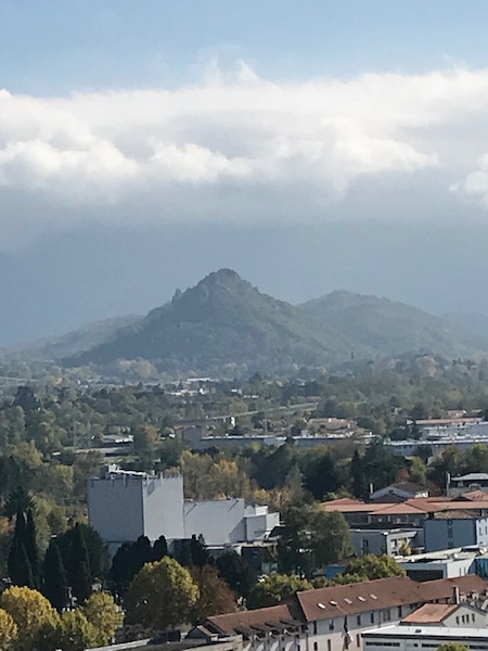
From the top, the Counts of Foix could control their territory, which stretched South to Andorra and Catalonia. From up here, you can see the first high peaks of the Pyrenees (when not overcast) as well as the rocky outcrop called the Pain de Sucre. Here is the picture which shows which one it is, and then our picture.
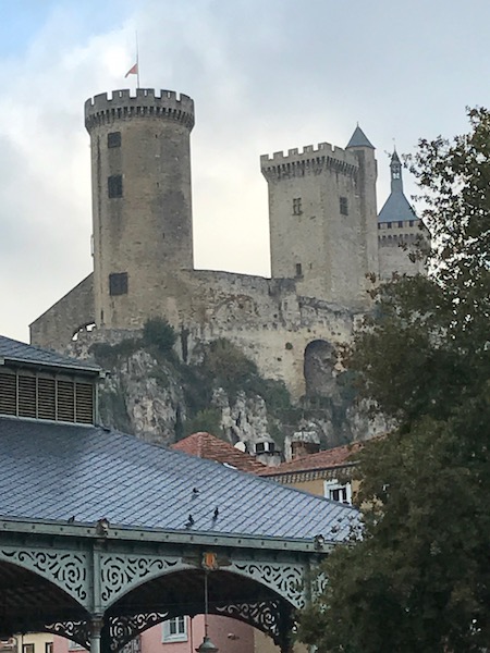
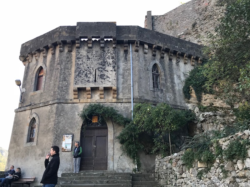
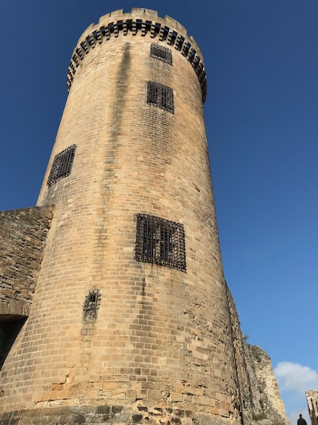
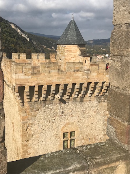
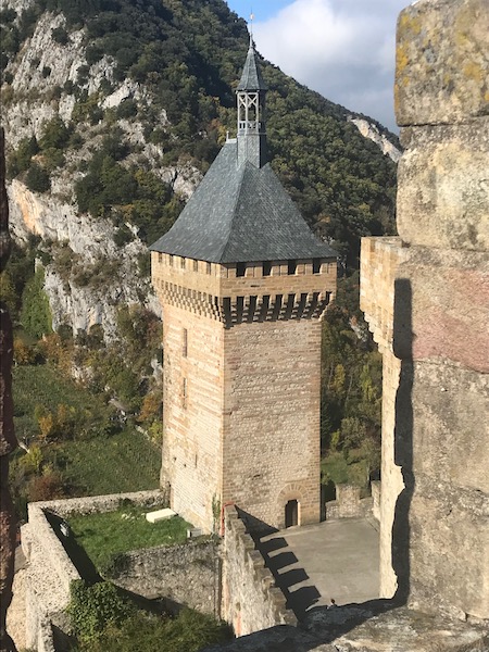
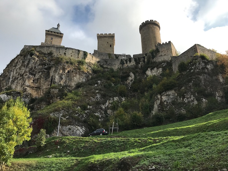
There are 3 towers: the Round Tower, The Middle Tower (yea, that is what it is called), and the Tour de L'Arget. Here is a good picture that shows the various walls and towers. The Tour d'Arget was the first tower and, unfortunately, it is not open to the public. They added the Middle Tower as well as a grand salon, which today has the information on the castle. These were built as massive, square towers of large stones. By the 14th century, the type of projectiles that would be used had changed ... they were now hollow metal balls that were not meant to destroy the building by putting holes in the wall. They would hit the wall but not make a hole or break it. It would cause vibrations and it is these vibrations that would cause the wall to come down. Hence the Round Tower. It was built on a point on the only side where the enemy would be able to launch these cannonballs from. The round shape would actually cause the balls to basically bounce off. You can also see how thick these walls are (compared to the other towers, one of the pictures shows a model of this), which also would keep the vibrations of anything that actually hit from causing damage. The position of the tower actually protected the other 2 towers from being hit.
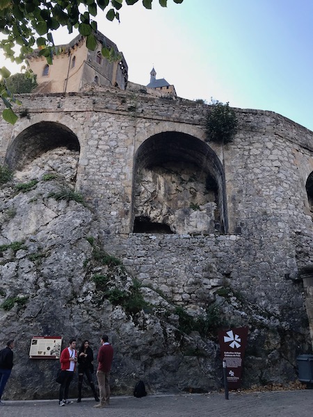
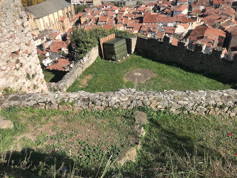
This area is called the 'outer bailey' and would be the area between the entry and the heart of the fortification. It allowed movement of troops between the main ramparts and the inner walls, and was the main area that was used to defend the castle.
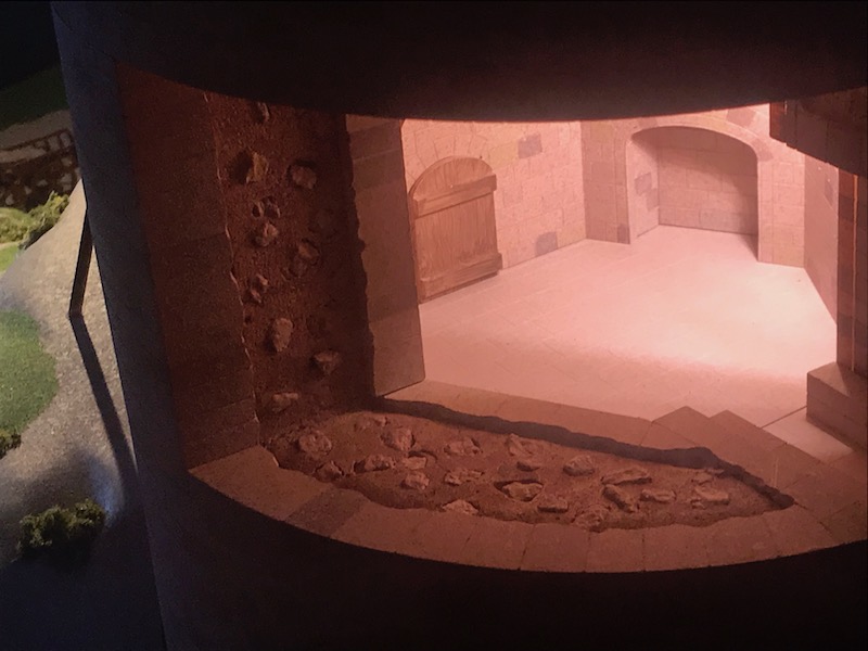
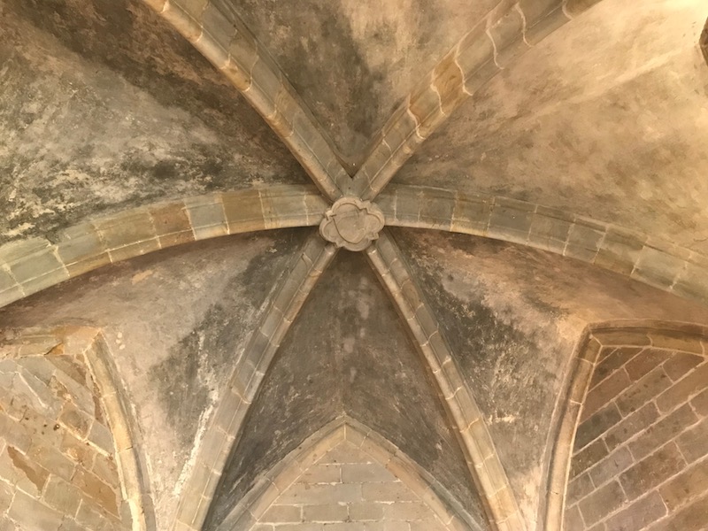
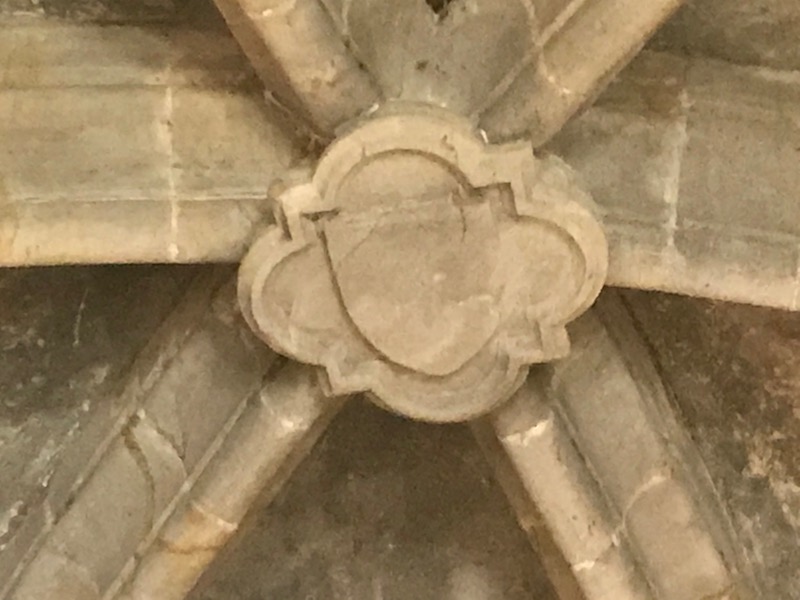
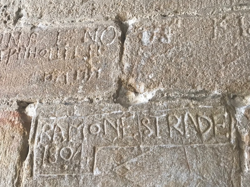
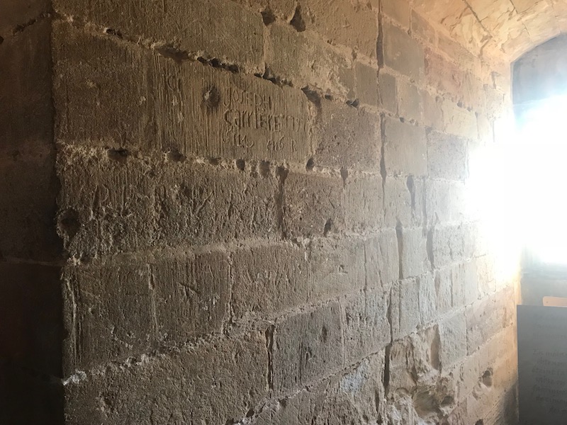
Now inside the Round Tower ... you can see the vaulted ceiling with the keystone in the middle of the ribs. At one point in time, it was turned into a prison and you can see in this one room where names of the prisoners got carved into the walls.
From the top of the Round Tower, you can see the detail at the top of the square Middle Tower, as well as the smaller L'Arget Tower on the northern side.
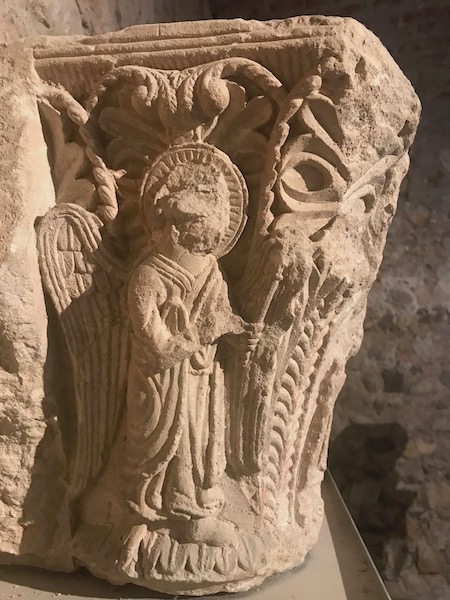
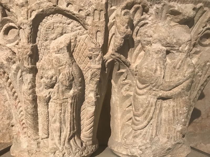
Within the grand salon, or the living area that was built between the Middle Tower and the L'Arget Tower, there was information on the castle, but it also had some remnants from the Abbey (why they are there are not in the Abbey, I can't say). This one specifically, is a capital that would have been against a wall, either literally built into the wall or on a pillar up against a wall, since the back was flat and not carved. This capital recounts the legend of Saint Volusien, for whom the Abbey is named. You can see how the head and face of the main figure has been hammered off, most likely during the Wars of Religion.
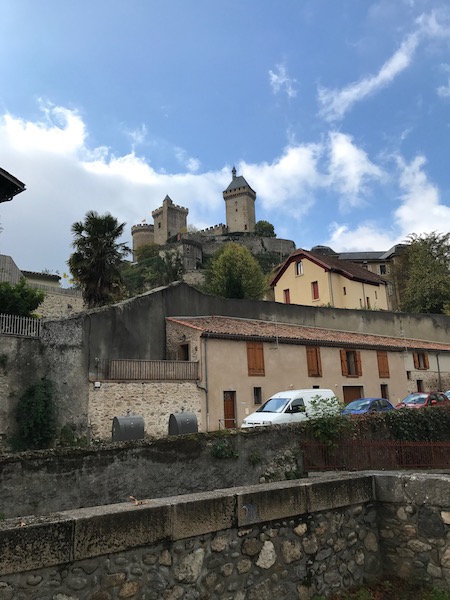
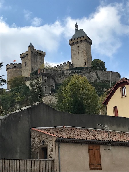
Here you can see the castle from various places around the bottom. You can see how it towers over the town, and you can see the 3 different towers. The back-side (starting with the 3rd picture), you can see the cliffs and defensive walls.
Castle with the Hall of Grains in the foreground. Here you get another view of the Halle aux Grains and can see a bit more of the top structure, which wasn't all that visible from the other angle.